The trials and tribulations of Wendy and John on their Grey Nomad adventure around Australia.

Monday, September 24, 2012

Griffith

In 1817 the explorer John Oxley described the area where Griffith is now situated as "uninhabitable and useless to civilised man". However in the late 19th century the government saw the potential for irrigation using the Murrumbidgee River, and in 1912 the water flowed and the Murrumbidgee Irrigation Area (or MIA) was born. Following World War I the population was given a boost as many farms were provided to soldier settlers, the memorial in Griffith's main street shows a World War I soldier with his hand on a plow handing over  a weapon to his son to go and fight in World War II.
 
The MIA is an abundant producer of citrus fruits and other fruit and vegetables. The area also produces 60% of NSW's grape harvest, with wineries specialising in botrytis style dessert wines. We did an interesting tour of a local mixed fruit farm, complete with tasting of the various farm products (although we cautiously restricted our intake of the prunes), and have been particularly impressed by the local mandarins bought at the Sunday market - much sweeter and juicier than the specimens normally obtained at a supermarket. We also did the rather dull heritage walk around town, and the rather more interesting local scenic drive.
 
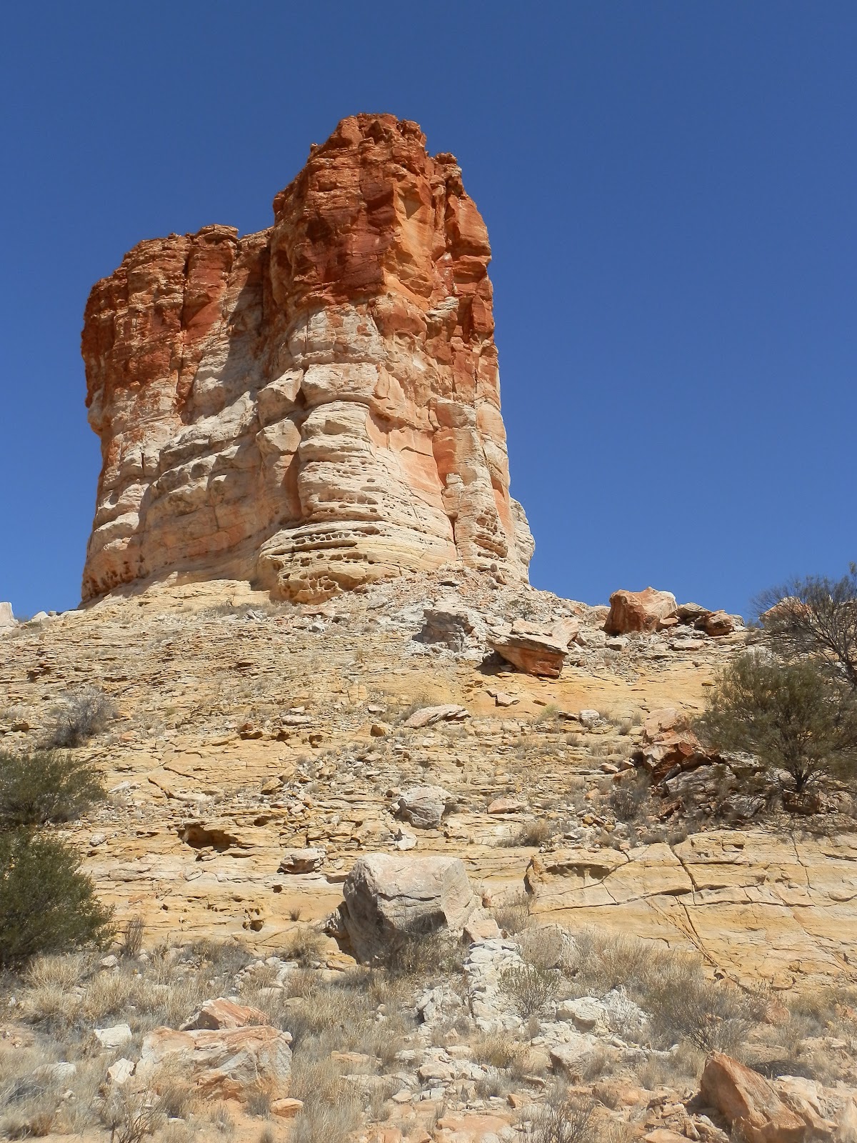
Cocoparra National Park (John Oxley again: "abandoned...by every living creature that is capable of getting out of them" - not a man who could be described as a visionary) is only about 25km from Griffith and provided us with some good walks along creek beds and climbing up to exposed ridges with terrific views across the fertile and colourful fields of the MIA.
 
On the way back from Cocoparra NP we took a 50km detour to the town of Leeton, intending to visit the SunRice visitor centre, which supposedly had displays on the local rice industry. However, when we got there we found the centre had closed last year, it would have been nice if the Griffith tourist brochure had been updated and saved us the journey.

Tuesday, September 18, 2012

Nuriootpa

Nuriootpa is at the top of the Barossa Valley, probably South Australia's most famous wine district. We've visited the valley several times before, most recently when we stayed at Gawler (which is at the foot of the valley) last year, but also in previous South Australian holidays. The Barossa specialises in full bodied red wine, we usually only drink white so weren't really interested in visiting any of the 77 cellar doors listed on the tourist map we picked up (besides, you'd need to stay for at least a month to do justice to them all). We did, however, stop at a couple of cool climate wineries as we drove through the Clare Valley on the way here, picking up some lovely crisp Riesling, which is much more to our taste.

Instead of wineries we explored some of the marked walking trails around the valley, and had several lovely lunches in the numerous cafes, pubs and boutique breweries that always go hand in hand with any wine district. Unfortunately the weather hasn't been particularly kind to us here, so we only got in one of the games of golf we had planned, however that turned out to be a profitable one as, although we both played pretty ordinarily, Wendy managed a good shot on the one hole that really counts and came away with a $75 voucher for winning the pro-pin.

Wednesday, September 12, 2012

Port Pirie

We had 2 very long days driving southwards from Alice Springs, and have now spent a few days in Port Pirie in South Australia to recover. Port Pirie is on the eastern shore of the Spencer Gulf, and apart from being the service centre and export hub for the surrounding farming country it also hosts the world's largest lead smelter. This plant processes and exports multiple minerals apart from lead, and dominates the skyline for many kilometres around. We did the tour, which unfortunately didn't allow us to get out of the bus or take any photos, or even open the bus windows. Given all the workers had to wear breathing apparatus to guard against poisonous lead dust, perhaps not opening the bus windows was a good idea after all.

Inland from Port Pirie is the southern section of the Flinders Ranges. We spent some time exploring the northern parts of these ranges at the very start of our grey nomad adventures, and took the opportunity now to see what the southern ranges had to offer. The northern Flinders Ranges is very rugged and isolated, with a few mining and pastoral settlements clinging to the dry unforgiving land. Imagine our surprise to find that the southern Flinders Ranges is lush farmland and rolling hills, with prosperous towns offering cafes, wineries, olive groves and local produce for sale. Luckily for us it also offers several national parks with good walking through gorges and up to lookouts, so we got the best of both worlds in our couple of days exploration.

We're now discovering the downside of coming down to the southern part of Australia. Not only have we experienced our first rain showers in nearly 5 months, the forecast top temperature for tomorrow is barely more than the lowest overnight low we've experienced in that time!

Friday, September 7, 2012

Finishing Off in Alice

We've had a very busy and active time in Alice Springs. Apart from our journeys to Chambers Pillar and Rainbow Valley, we've had multiple trips to the west of Alice Springs. If we'd planned our time a bit better we would probably have actually taken the van out to the far end of the West MacDonnells and based ourselves there for a few days, but we didn't think of that soon enough. As it is we've covered over 1,500 km in our 11 days here, which is an awful lot considering the amount of driving we did to get here from Darwin (and the amount we'll be doing after leaving here to head south to our next destination).

Although it looks like the remnants of volcanic action, Gosse Bluff is actually the remains of an impact crater from a comet that hit around 142 million years ago. The original crater must have been impressive indeed, even with the erosion that has occurred over that incredible amount of time the crater walls stand stark above the surrounding flat plains. Not surprisingly the crater is a deeply spiritual sacred site for the local Aborigines, and access is restricted to a couple of lookouts and a short walking track inside the crater walls. On the same day we also visited Redbank Gorge, doing the walk down the rocky and sandy creek bed to a permanent waterhole. A group of European backpackers headed down the walk just before us, when we arrived at the waterhole they were taking it in turns to leap into the waterhole (modestly attired in bikinis and bathers) then rush shrieking back to dry land. Even here in the red centre the water is barely above freezing, not a pleasant swimming spot even on the hottest days. The backpackers willingly informed us it was there first bathing chance for a couple of days, luckily we weren't there to swim, just look at the scenery.

Finke Gorge National Park is about 138 km west of Alice Springs. The last 16 km is a 4wd track that largely goes along the bed of the Finke River. The last 4 km of this track is so rough that it took us 20 minutes, but at the end is one of the wonders of central Australia - Palm Valley. This narrow canyon is home to a remnant population of cabbage tree palms and cycads, left over from a much wetter ancient time. The creek side walk leads beside the palm groves, then returns along the cliff edge, providing panoramic views across the palm trees. The rest of the park is more usual desert country, the other walk we did was beside the dry creek bed once it exited the canyon, and over typical red, sandy country.

Ormiston Gorge, at the western end of the MacDonnell Ranges, has an international reputation as a classic central Australian destination. The red cliffs, dry landscape and rugged countryside provide the quintessential red centre experience. We first did a short walk to a lookout with a beautiful ghost gum tree bravely clinging to the rock edge, then tackled the 7km circuit walk, through the ranges next to the gorge, then back through the middle of the gorge. The gorge portion was extremely tiring, involving not only slogging through deep sand, but scrambling over tumbled rocks and even at one stage wading through a freezing cold water hole. Luckily the water was less than knee high, apparently at some times it laps the crotch....

Apart from all the driving and walking, we've found some time in Alice to do some maintenance on the car and to have a couple of games of golf at the superb Alice Springs golf course. We now feel that we've 'done' this central Australian oasis, and have plenty of wonderful memories to take away.

Sunday, September 2, 2012

Chambers Pillar and Rainbow Valley


It's been over 3 years since we were last in Alice Springs, but not a lot has changed in Australia's unofficial capital of Central Australia. Last time we were here we pretty well saw most of the sights available in town, and spent only a single day in each of the East and West MacDonnell Ranges. This visit we have planned to spend more time exploring the stunning landscapes that surround this city in the middle of the desert.
Chambers Pillar is about 160 km south of Alice Springs, accessed by a dirt road that deteriorates to a 4wd track for the last 40 kilometres. The photo at right (see if you can spot John waving) shows just how featureless the area around the pillar is, and gives an idea of how much of a landmark it is. The first white person to see Chambers Pillar was John McDouall Stuart, during his first attempt to cross Australia in 1860. It is a sandstone pillar that is capped by a hard iron-rich layer that has prevented the soft sandstone from eroding. Many travellers have carved their names into the base of the pillar, starting with the workers constructing the overland telegraph line in 1872, but this practice is now of course illegal and heavily discouraged. There is a walking track around the pillar and a platform built right against its base so you can get a close-up view of the historic (and not so historic) graffiti.
 
On the way down to Chambers Pillar we stopped at the Ewaninga Conservation Reserve, which protects rock engravings (petroglyphs) created by the original Aboriginal people of the area. The carvings are on a small rock outcrop next to a clay pan - in this dry climate the clay pan would hold water for a considerable period after any rain, making this a favoured site for longer stays by the Aboriginal people and giving them some leisure time for recording their beliefs in the soft sandstone. The meaning of the petroglyphs is sacred and cannot be revealed to people not initiated into Aboriginal lore.
 
Rainbow Valley is another area where hard capping protects soft white sandstone cliffs. Although probably only about 50km from Chambers Pillar, it is accessed by a completely different road from Alice Springs, so we visited here on a different day. The colour variation of the cliffs has been caused by water. In earlier, wetter times the red iron of the sandstone layers were dissolved and drawn to the surface during the dry season. The red minerals formed a dark, iron rich surface with the leached white layers below.
Like the rest of Australia, Spring has arrived in the red centre, and even this dry, sandy place is producing a profusion of wild flowers. You have to look a bit harder to find them, but when you look in the right places there is a surprising variety of colourful blooms, determinedly continuing the outback cycle of life.

About Us

My photo
We set off on the grey nomad adventure on 17 March 2009. This blog shows photos and comments of our adventures.

Itinerary for Mail

Itinerary for Mail